StreamLine VS+
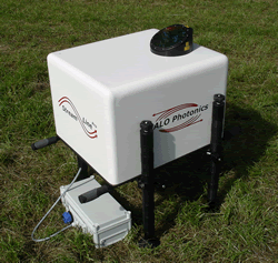
The StreamLine VS+ Doppler LiDAR system is suited to boundary layer profiling with proven optical arrangement and components. It is an autonomous, turn-key LiDAR system incorporating an internal scanner housed in an environmental enclosure.
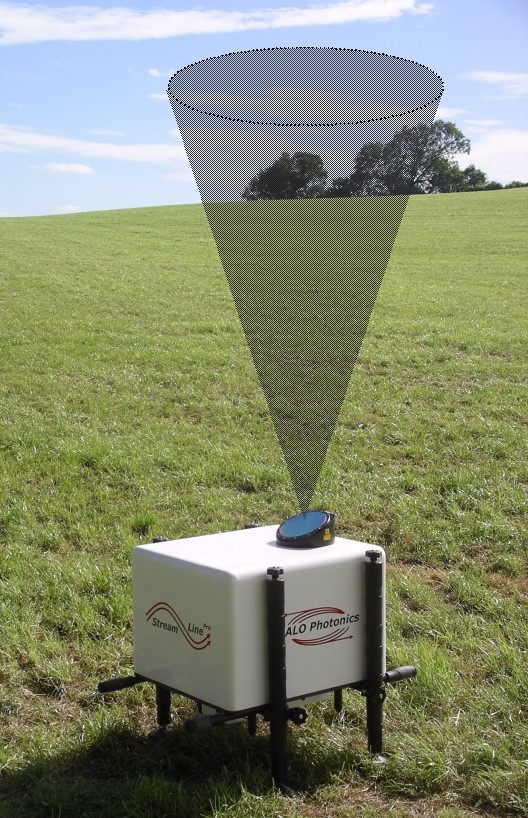
The internal scanner gives a reduced field of regard of 70° to 90° in elevation at any azimuth. The flexible data acquisition software allows VAD scans, DBS wind profiles, staring and arbitrary scans to be scheduled. The further wind profiling software allows 4 to 360 points VAD + vertical scans, with an update every 2 seconds at all heights – which could be up to 3200 heights.
Its accurate scanner, data acquisition makes it suited for a wide range of application from wind resource assessment prior to wind turbines installation to electricity production optimization along the wind turbines farms exploitation.
Main features
- Conical field-of-regard optimized for profiling in the boundary layer and lower troposphere
- Field deployable
- Turnkey operation
- Eye safe (Class 1M)
- 24V DC
- Modular construction
- UDP data broadcasting
- GPS option for time syncing etc.
- Optional met mast
- Optional de-polarisation mode
- IP66
- Real-time data processing to 12 km is available with a 100 % duty cycle
- Overlapping range gate option
- 3900 range gates at 100 % duty
- Elevation angle range 70° to 90°
- Low power, air cooled
- Data logged in ASCII
- Flexible software
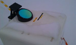
- Heated window blower
- Remote monitoring/control
- Scan scheduling
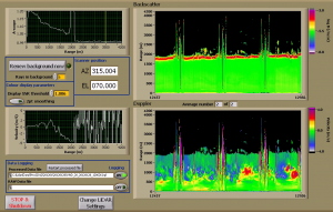
Real-time data quick-look showing vertical profiling with periodic wind profiles.
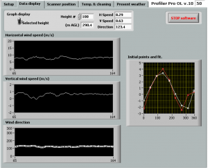
A screen shot from the continuous profiling mode where u,v,w are continuously monitored at a series of pre-determined heights.
Typical applications
- Cloud studies
- Wind profiling
- Air quality monitoring
- Pollution dispersion
- Wind shear monitoring
- Boundary layer meteorology
- Airports:
- Wind profiles
- Cloud base mapping
- Visibility
- R&D:
- PBL mapping
- Eddy dissipation rate
- Cloud research
- Water/ice discrimination
- Environmental monitoring:
- City pollution mapping
- Air quality assessment
- Pollution dispersion
- Meteorology:
- Wind profiling
- Visibility
- Boundary layer mixing height
- Scanning ceilometer
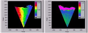
Line-of-sight Doppler (left panel) and return power (right panel) data from RHI scans of ±20 degrees from vertical. The data show aerosol returns up to a cloud layer at around 1500 m.
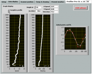
Boundary layer wind profiles at 2.6m height resolution every few seconds.
Technical specifications
- Internal 2-axis programmable scanner with a conical field-of-regard of ± 20°
- Real-time data acquisition to 12 km
- Raw and processed data storage
- Data broadcasting
- Backscatter, line-of-sight velocity, wind, turbulence & cloud profiling
- Receiver bandwidth ± 20 ms-1
- Line-of-sight velocity precision < 20 cms-1 for SNR > -17 dB
- Actively and passively cooled versions
- Mature, proven technology
- Power consumption:130 W 24 V DC (+250 W at 50°C)
- Environmental: -20 to 50°C
- Weight: 60 kg
- Dimensions: 60 x 53 x 40 cm
- Autonomous, Rugged and Eye-safe: Class 1M