Environmental and climate monitoring
The StreamLine LiDAR can be used to detect and track elevated levels of certain pollutants in the atmosphere. The data examples below show the LiDAR detecting volcanic ash, farm crop spraying aerosols and forest fire smoke plumes.
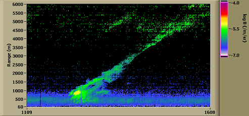
Crop spraying pollution dispersion
This data was collected with the StreamLine sited close to a field that was being sprayed by a crop sprayer. The LiDAR was staring at 10 degrees elevation at a diagonal orientation to the wind flow.
The 6 km range corresponds to the line of site range – so at 6 km, the height above ground level was approximately 1 km. The screenshot represents ~ 6.5 minutes in time.
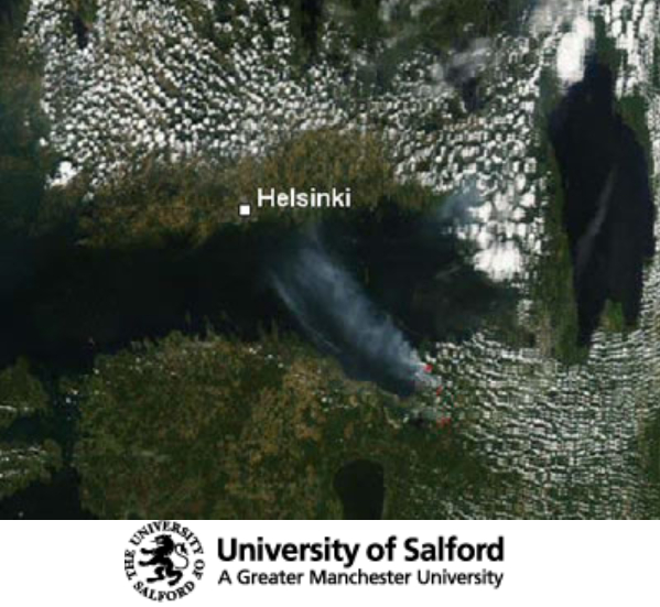
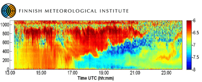
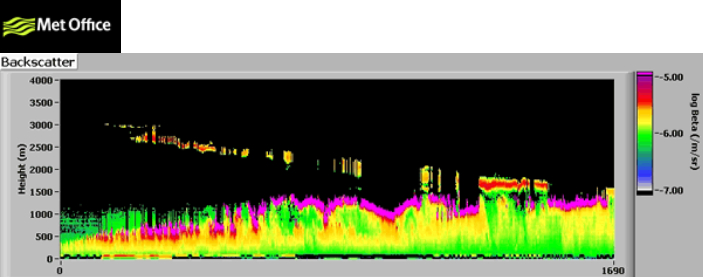
Smoke detection from Russian forest fires during deployment in Helsinki, Finland in August 2006
Volcanic ash cloud detection and monitoring
The HALO Photonics LiDAR operating in Manchester was the first LiDAR in the UK to detect the ash cloud from the Eyjafjallajokull volcano.
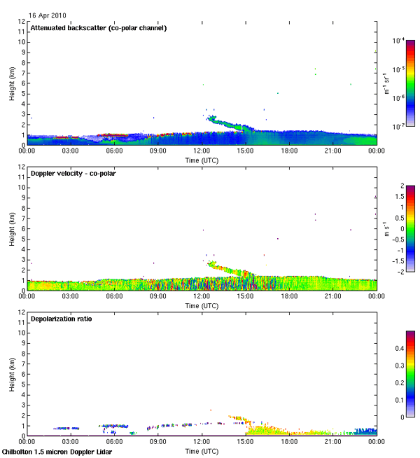
This data is from the Chilbolton Doppler LiDAR, which is also fitted with a de-polarisation channel. The ash shown drifting down at approximately 12:00 and enters the boundary layer at 15:00. In the de-polarisation ratio plot at the bottom, the ash can be seen to fill the turbulent boundary layer.
This data, also from the 16th of April 2010, was collected by the HALO LiDAR at the Met Office research site at Cardington.